SATELITE DETECTION
Advanced Fire
Information
System
ADVANCED FIRE INFORMATION SYSTEM (AFIS)
Wildfire Information Monitoring and Visualization framework.
AFIS (Advanced Fire Information System) is a wildfire information monitoring and visualisation frameworks that provide fire prediction, detection, monitoring, alerting, planning and reporting capabilities utilising Earth observation satellites, weather forecast models and Information and Communication Technologies.
ACTIVE FIRE DETECTION
AFIS utilises a portfolio of GEO (Geostationary Orbit) and LEO (Low Earth Orbit) Earth observation satellites to detect wildfires globally and is fully integrated with the FireHawk camera system. Locations and images of fires detected by FireHawk are available on the AFIS Web Viewer and Dashboard.
FIRE DANGER RATING
Four day fire danger forecasts for any location based on the Canadian Fire Weather Index or any custom user specified model. Weather Forecast data acquired from ECMWF (European Centre for Medium range Weather Forecasting).
BURNED AREA ESTIMATION
The CSIR has produced a new merged burned area product by fusing the standard MCD45 and MCD64 MODIS products.
FIRE DASHBOARD
The Fire Dashboard was developed for a control centre environment where operators can setup, integrate and visualise various data sources for a specific area of interest. The dashboard consists of widgets that represent various components such as a dynamic table, Fire Danger forecasts and animated satellite imagery.
STATISTICS PLATFORM
The AFIS Statistics data portal provide burned area estimates for any administrative boundary or pre-defined area of interest. The statistics are provided in hectares per month for the MODIS merged burned area product (500m) as well as the Landsat 8 burned area product (30m). All statistics are automatically calculated and updated within the data portal.
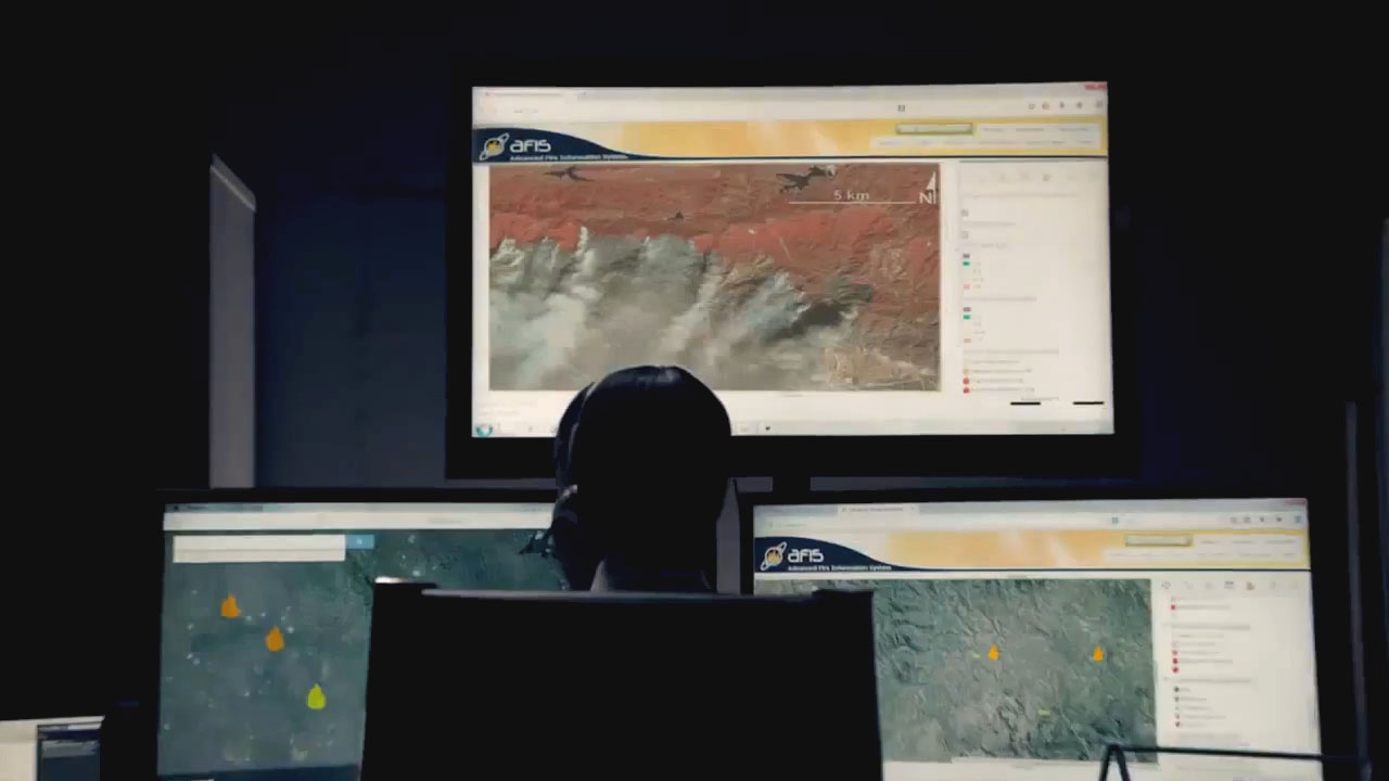
WEB VIEWER
The AFIS web viewer is an online GIS system that integrates dynamic fire information with baseline localised data sets to help with planning and the analysis of current and historical fire patterns.
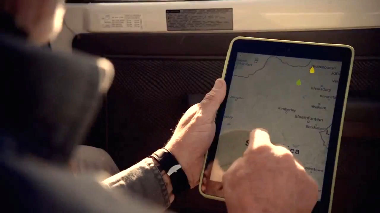
MOBILE APPLICATION
The AFIS mobile application assist fire managers with fire prediction, detection and historical information based on current location or any defined area of interest. It also includes weather forecasts and vegetation conditions.
ALERT PLATFORM
The AFIS alert platform is a state-of-the-art multi-dimensional alert messaging system with a built in GIS capability to allow for the dissemination of various types of alert messages. The alert platform not only allows for basic alerts protocols, but allow users to receive messages based on rule based algorithms.
AFIS was developed in partnership with fire managers from the forestry and utilities domain over more than 10 years, and integrates integrates satellite based and forest camera detections into a seamless detection network. It is a hosted software solution and supports both ground based resources through mobile solutions and dispatch control centers with a fire dashboard and integrates with any existing GIS platforms and CMSs (Content Management Systems).
AFIS PREDICT
PROACTIVE
- Fire Weather/Danger Forecast 10 day hourly.
- Fire Weather/Danger Nowcasting using Private weather stations.
- Fire Risk Model based on FDI, fuel load, condition, topography, high value areas.
- Vegetation condition estimates.
AFIS DETECT
MULTI-MODE
- GOES, MODIS,VIIRS plus Landsat 8, Sentinel 2, FireBird.
- Dynamic Fire Spread Modelling, Active Fire profiling.
- Alert – SMS/email/internet push notification.
- Crowd sourcing detection through AFIS Watchtower app.
- Integration with Forest Camera detections.
AFIS ASSESS
RAPID
- Landsat/Sentinel 2/Deimos access.
- Automated Landsat/Sentinel Burn Area mapping.
- Fire Spread Analysis post fire.
- Post fire forensic analysis from high resolution satellite and in situ data.


CONTACT
Request more information.
CONTACT
Rua Luis Spiandorelli Neto
30, Sala 301
Jardim Paiquerê
Valinhos-SP, BraZil, CEP 13271-570
Tel: +55 19 3246 1534

